ESRI Dashboard / Water management
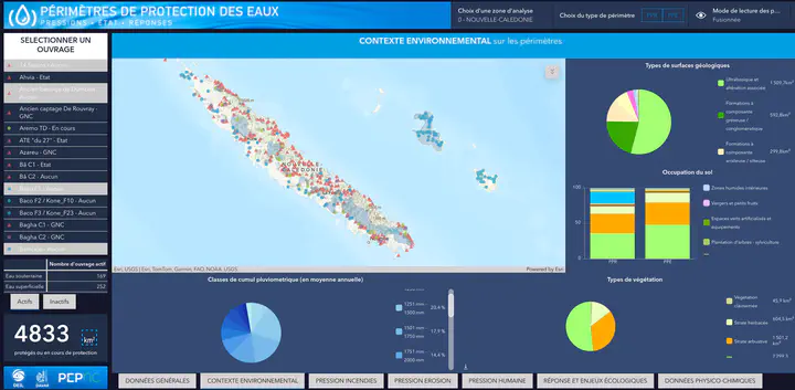
📝 Drinking water resource monitoring project in New Caledonia
Context: As part of my role within an environmental association, I was responsible for the information systems and geomatics projects division. I was given a simple mission: to design a territorial dashboard for monitoring the drinking water resource across New Caledonia, for a public institution (DAVAR).
Objectives:
- Identify, formalize and produce around ten relevant geographic indicators for monitoring the resource.
- Build a sustainable and reproducible technical solution, scalable in the long term.
- Automate the processing and aggregation of vector geographic data (provided by the contracting authority).
Role and actions:
- Design and development of a scripted geospatial processing framework (Python/GDAL, YAML), with geometric intersection, filtering, aggregation steps, etc.
- Structuring data according to a bronze / silver / gold logic (Data Lakehouse model adapted to geographic data).
- Setting up a data catalog and standardized models to facilitate multi-scale analysis.
- Explicit refusal of manual processing (QGIS-type), in favor of an industrialized, reproducible and documented system.
- Constant dialogue with public partners to refine indicators and anticipate future uses, applying an agile approach.
Results and impacts:
- Successful delivery of the first version of the dashboard and indicators.
- Adoption of the framework as the technical foundation for all future environmental projects of the observatory.
- Significant time savings in subsequent projects and greater reliability of processing.
- Building a culture of automated and maintainable processing within the team.
Lessons learned:
- The importance of imposing a clear and robust technical vision, even when it diverges from existing practices.
- Training and pedagogy are key factors in getting teams to adopt more advanced technical tools.
- A well-considered methodological choice can generate a lasting leverage effect at the scale of an organization.
Skills used
Data Visualisation
Data Management
Python Development
Data Automation
Data Lakehouse
Data Processing
Data Analysis
Data Engineering
Technologies used
Python
GDAL
YAML
DBT
ArcGIS Online
ArcGIS
Bibliothèques Python
- Pandas
Library for data manipulation and analysis.
- rasterio
Reading and writing geospatial raster data.
- geopandas
Pandas extension for working with geospatial data.
- intake
Data discovery, management and access.
- Dask
Parallel processing of large-scale data.