QGIS Atlas / Wildfires
Project description
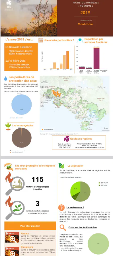
Building a complex cartographic atlas with QGIS, retracing the history of wildfires in every municipality of New Caledonia over the past 20 years. The atlas combines land cover data, administrative boundaries and fire histories to produce a series of consistent, reproducible map sheets.
The production chain relies on the QGIS atlas generator: a single layout model, parameterized by municipality, automatically generates all the map sheets. Each sheet includes the maps, municipal statistics and legend elements needed to read wildfire dynamics.
Skills used and deliverables
- QGIS
- Data Visualisation
- Data Management